All official European Union website addresses are in the europa.eu domain.
See all EU institutions and bodies
An official website of the European Union | How do you know?
Environmental information systems
EN


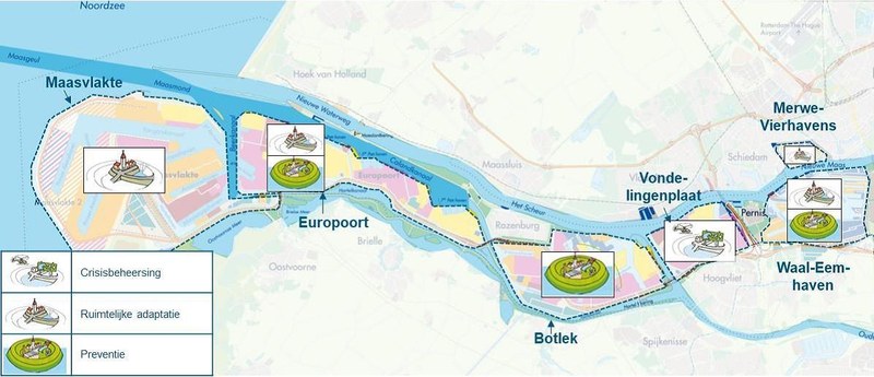
Port of Rotterdam – Adaptation Strategy Map
The thematic map divides Europe’s largest port into colour-coded zones. They illustrate where crisis-management measures (e.g., flood-ready logistics hubs), spatial adaptations (elevated quays, floating facilities) and long-term preventive works (reinforced sea dikes, storm-surge barriers) are recommended to safeguard operations under rising sea levels and extreme storms. Author and source: HASKONINGDHV Netherlands B.V. - Een waterveilige Rotterdamse haven - Een adaptatiestrategie voor een veilige haven - nu en in de toekomst. Case study: https://climate-adapt.eea.europa.eu/en/metadata/case-studies/rotterdam-port-adaptation-strategy-for-climate-resilient-transport-and-business-activities
Language preference detected
Do you want to see the page translated into ?
Exclusion of liability
This translation is generated by eTranslation, a machine translation tool provided by the European Commission.
Exclusion of liability
This translation is generated by eTranslation, a machine translation tool provided by the European Commission.