All official European Union website addresses are in the europa.eu domain.
See all EU institutions and bodies
An official website of the European Union | How do you know?
Environmental information systems
EN


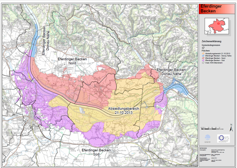
The map of Eferdinger Becken flood protection measures plan
The area marked with yellow in the map is the area designated for resettlement. The other marked areas will be protected by other flood protection measures which are currently in planning. Author: Amt der OÖ. Landesregierung, Abteilung OGW. Source: https://www.land-oberoesterreich.gv.at/Mediendateien/Formulare/DokumenteAbt_W/sw_Eferdinger_Becken_Uebersichtsplan.pdf. Case study: https://climate-adapt.eea.europa.eu/en/metadata/case-studies/relocation-as-adaptation-to-flooding-in-the-eferdinger-becken-austria
Language preference detected
Do you want to see the page translated into ?
Exclusion of liability
This translation is generated by eTranslation, a machine translation tool provided by the European Commission.
Exclusion of liability
This translation is generated by eTranslation, a machine translation tool provided by the European Commission.