All official European Union website addresses are in the europa.eu domain.
See all EU institutions and bodies
An official website of the European Union | How do you know?
Environmental information systems
EN

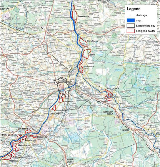
Overview of designated reservoirs to increase retention capacity along the Upper Vistula
The map indicates the designed reservoirs along the Upper Vistula River. The arrows indicate interventions implemented in the towns of Sandomierz (upper arrow) and Kocmierzow (lower arrow). Source: Arcadis (reproduced in EEA 2017 Green Infrastructure and Flood Management. Promoting cost-efficient flood risk reduction via green infrastructure solutions Report No. 14, 2017.
Language preference detected
Do you want to see the page translated into ?
Exclusion of liability
This translation is generated by eTranslation, a machine translation tool provided by the European Commission.
Exclusion of liability
This translation is generated by eTranslation, a machine translation tool provided by the European Commission.