All official European Union website addresses are in the europa.eu domain.
See all EU institutions and bodies
An official website of the European Union | How do you know?
Environmental information systems
EN

The Municipality of Troskotovice is leading climate adaptation using a targeted approach to protect its roads. Combining data allows ranking and prioritising roads more effectively, strengthening climate resilience. This innovative, data-driven approach shows how small communities can make a change with limited resources, offering a practical, scalable solution for other rural regions to adopt.
Key Learnings
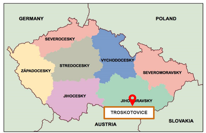
About the Region
Climate Threats
Troskotovice experiences more frequent extreme weather events, including prolonged periods of drought and intense heatwaves, which have increased the risk of water scarcity and put pressure on local agriculture. Yet, the village also experiences episodes of heavy rainfall and powerful storms, leading to flash floods that damage infrastructure and erode the fertile topsoil crucial for farming. The combination of these hazards has created a challenging environment for both the natural ecosystems and the human communities dependent on them. The ongoing changes in Troskotovice's climate highlight the urgent need to prioritise roads for climate adaptation measures to ensure the functionality of critical infrastructure, including road projects, bio corridors, and swales.
An Iterative Process for Developing the Prioritisation Approach

Figure 1: First workshop with the stakeholders in Troskotovice municipality. Image Credit: Sandra Fatorić, Dita Tesarova, Policy Support Facility Experts, Covenant of Mayors Europe.
Applying the Prioritisation Approach
The prioritisation approach combines data on social and environmental values with climate change risks identified for Troskotovice, such as drought, wind erosion, water erosion, and water runoff. This helps to compare and prioritise adaptation strategies targeting roads systematically. An expert team reviews each indicator and its related metrics and scores and determines their importance. For more information on the descriptions of the approach's components, Figure 2 provides an overview.
The approach is then organised into an Excel file with six spreadsheets that can be used to assess, compare, and rank the selected roads quantitatively.

Figure 2: Diagram of climate change hazards with its indicators (In blue boxes) and associated metrics with scores (in white boxes). Image Credit: Sandra Fatorić, Dita Tesarova, Policy Support Facility Experts, Covenant of Mayors Europe.
Elements of Uses, Readiness and Environmental Values
The assessment considers:
- Uses: The importance of current road uses for accessibility, tourism, traffic reduction, and wildlife.
- Readiness of Measures: Factors like land ownership and technical documentation status.
- Environmental Values: Ecological stability, endangered species, and the road's impact on biodiversity.
Similar to climate change hazards, each measure is given a numerical score. The calculation involves assigning the weights to each indicator and their relationship. These scores are normalised to a scale between 0 and 1 to represent the relative importance of each factor and their connections to climate change hazards, road uses, readiness, and environmental values. In essence, the weights reflect the significance of each measure based on its relationships to these elements and its overall impact.
Pilot Application of the Approach
For the approach's pilot test, a group of 16 roads within the municipality of Troskotovice was selected. The team entered scores for each indicator and then reviewed them to validate the approach. An example from this pilot test is included in Figure 3.

Figure 3: Example of the pilot test of the prioritization approach using 16 roads in the Municipality of Troskotovice. Image Credit: Sandra Fatorić, Dita Tesarova, Policy Support Facility Experts, Covenant of Mayors Europe.
Transferability of the Prioritisation Approach
The transferability of this structured, data-driven methodology is significant, empowering small municipalities to make impactful decisions despite limited resources. This scalable model can inspire similar regions to adopt customized strategies for infrastructure resilience, especially under financial or technical constraints. Municipalities across Europe can adapt the prioritization approach to address climate change risks to their road infrastructure, tailoring it to their specific needs. Regional decision-makers have tested the effectiveness of the approach and have confirmed its applicability, demonstrating that even small communities can implement solutions that resonate with their unique challenges.
Direct Benefits and Next Steps
The prioritisation approach can stand alone as a transparent tool for assisting road decision-making processes. Therefore, decision-makers can apply only uses, readiness, and environmental values or, when combined with climate change hazards, rank and prioritise roads for their adaptation potential.
After their evaluation and prioritisation, the next step towards implementing the measure is the search for suitable funding sources and the technical elaboration of their concrete form-design work. Based on these steps, authorities can adapt individual sites.
Summary
Further Information
Contact
Keywords
Climate Impacts
Adaptation Sectors
Key Community Systems
Countries
Funding Programme
Disclaimer
The contents and links to third-party items on this Mission webpage are developed by the MIP4Adapt team led by Ricardo, under contract CINEA/2022/OP/0013/SI2.884597 funded by the European Union and do not necessarily reflect those of the European Union, CINEA, or those of the European Environment Agency (EEA) as host of the Climate-ADAPT Platform. Neither the European Union nor CINEA nor the EEA accepts responsibility or liability arising out of or in connection with the information on these pages.
Language preference detected
Do you want to see the page translated into ?
Exclusion of liability
This translation is generated by eTranslation, a machine translation tool provided by the European Commission.
Exclusion of liability
This translation is generated by eTranslation, a machine translation tool provided by the European Commission.