All official European Union website addresses are in the europa.eu domain.
See all EU institutions and bodies
An official website of the European Union | How do you know?
Environmental information systems
EN


Key message
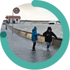
Gather up-to-date information to support the case for adaptation in your area. Start building a robust evidence base to inform policymaking and guide adaptation planning in your local or regional authority.
It’s important to collect relevant available information to support adaptation planning, ensuring a well-prepared start to the adaptation policy cycle. This can include evidence on past weather and climate extremes, data on current and potential future climate impacts, ongoing and planned adaptation actions, and good practice adaptation examples from your region or elsewhere.
An initial review of the information allows you to assess the current status of risks and adaptation efforts in your area. The information is crucial for the climate risk assessment in Step 2.3. It also forms the basis for advocating for local adaptation, helping political leaders and citizens understand climate challenges – both current and future, and their impacts on different social groups/sectors/systems – and identify priorities for effective adaptation measures. You should use this evidence to draft a persuasive message for local and regional decision-makers, emphasising the urgency of decisive action, as outlined in Step 1.2.
You can find information from the following sources:

Data providers in your country

Local and regional information providers
Tap into your own organisation's resources (e.g. existing data on socio-economic conditions, vulnerability assessments, environmental assessments, adaptation projects, policies and plans related to spatial planning and sustainability). Check for hazard studies or maps for your area, as current climate risks may worsen in the future. Collaborate with colleagues to organise this data efficiently and consult local studies from universities and research centres. Early involvement of citizens and other stakeholders can provide valuable insights into local issues and citizen science (for stakeholder mapping, see Step 1.3).

National adaptation and climate portals
Check national portals for information. You can find an overview of these at Climate-ADAPT Country Profiles. The profiles provide current information on national adaptation efforts, including case studies, best practices and sub-national progress.
Danish Climate Atlas
This tool provides municipal-level data on climate and infrastructure. It brings together local-level data so municipalities can make evidence-based decisions on how to protect citizens from the impacts of climate change.
Drents AdaptatieBeeld (DAB)
Drenthe, a rural Dutch province, is proactively addressing climate change through the Drents AdaptatieBeeld (DAB), a platform designed to visualize and plan for climate impacts such as warming, increased drought, and heavy rainfall. The tool integrates Story Maps to convey tailored scenarios, offering actionable insights on risks like soil subsidence and water shortages. By combining data-driven predictions with community engagement, DAB supports adaptation strategies like wetland restoration and behavioural changes. This initiative exemplifies the use of data to inform effective local responses to climate-related challenges, fostering awareness and collaboration across stakeholders.

European platforms

Adaptation Dashboard for sub-national regions - Mission Portal
This tool, designed to assist decision-making, provides insights into climate risks and has comprehensive information on impacts and adaptation policies for European sub-national regions. It integrates data from the European Climate Data Explorer.

European Climate Data Explorer
It gives interactive access to climate indices from Climate-ADAPT and the Copernicus Climate Change Service. To see data on past, present and future climate hazards, go to ‘Overview list of all indices’.

DRMKC Risk Data Hub
A Joint Research Centre platform offering decision-making support for disaster risk management at national and sub-national levels. Key features include a composite vulnerability index, risk estimation dashboards, single-hazard analysis modules and a knowledge library with guidelines and methodologies.

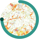
ESPON Portal
It offers interactive maps, dashboards, indicators on diverse topics related to territorial development, including the environment, climate and energy.

European Drought Observatory
For access to diverse drought data, including precipitation measurements, satellite data and modelled soil moisture content developing your own local indicators.

European Drought Risk Atlas
Provides insights into agriculture, water supply, energy, river transport and ecosystems, aiding with risk assessment and mitigation. Sub-national drought risk assessments are available for each sector – under current and future climate projections.

European Climate and Health Observatory
Explore indicators, publications and tools related to climate change and human health – aggregated at country level and categorised by hazards.

Viewer on the exposure of vulnerable groups
Access data on exposure to flooding of vulnerable groups (country level) and social infrastructure (NUTS 2), and on urban heat island effects on social infrastructure in selected cities, to help prioritise measures equitably.
Language preference detected
Do you want to see the page translated into ?
Exclusion of liability
This translation is generated by eTranslation, a machine translation tool provided by the European Commission.
Exclusion of liability
This translation is generated by eTranslation, a machine translation tool provided by the European Commission.