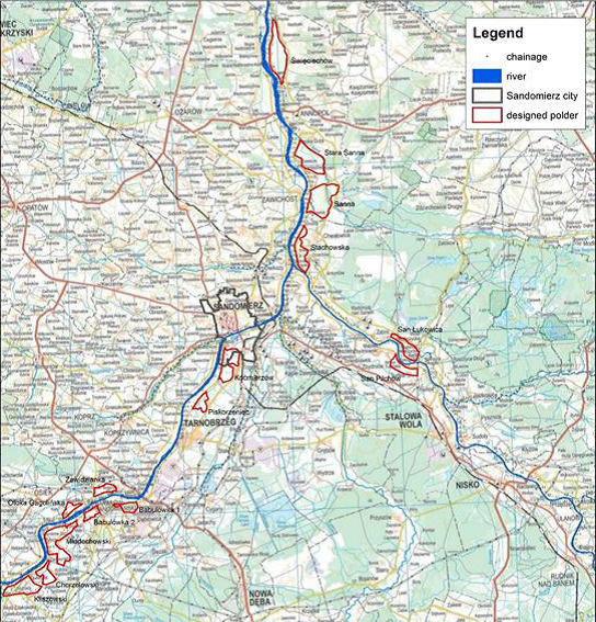
Overview of designated reservoirs to increase retention capacity along the Upper Vistula
The map indicates the designed reservoirs along the Upper Vistula River. The arrows indicate interventions implemented in the towns of Sandomierz (upper arrow) and Kocmierzow (lower arrow). Source: Arcadis (reproduced in EEA 2017 Green Infrastructure and Flood Management. Promoting cost-efficient flood risk reduction via green infrastructure solutions Report No. 14, 2017.

