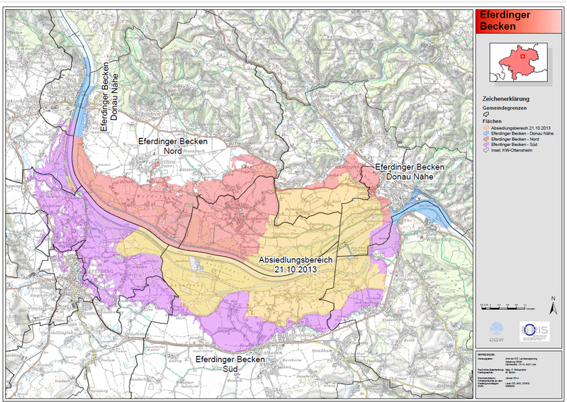
The map of Eferdinger Becken flood protection measures plan
The area marked with yellow in the map is the area designated for resettlement. The other marked areas will be protected by other flood protection measures which are currently in planning. Author: Amt der OÖ. Landesregierung, Abteilung OGW. Source: https://www.land-oberoesterreich.gv.at/Mediendateien/Formulare/DokumenteAbt_W/sw_Eferdinger_Becken_Uebersichtsplan.pdf

